WiRē
We have gained some valuable insight into the hearts and minds of our residents here in Routt County. The WiRē process pairs social data from residents living in the wildland urban interface with parcel level wildfire risk data. Using this community specific data, we now have a clearer understanding of how programs can be tailored to effectively move local residents to take action to reduce wildfire risk.
")
At the core of of the WiRē approach are two data collection efforts:
A rapid wildfire risk assessment based on attributes related to building materials, vegetation near the home, background fuels and topography, as well as access for the fire department to the parcel. The rapid assessment serves as an indicator of relative risk of parcels within a community rather than an absolute measure of risk. Rapid assessments were completed in the fall of 2023 and spring / summer of 2024.
Social surveys of the residents of the assessed parcels to investigate homeowners’ perceptions of wildfire risk, risk mitigation behaviors, and responses to incentives to mitigate risk. Household surveys were sent out in the spring / summer of 2024.
Training was conducted in September 2023 for a dozen volunteers and agency representatives so that we could effectively conduct Rapid Assessments on approximately 2,200 parcels throughout the County.
A series of neighborhoods were selected for the study. Some criteria have been established by WiRē based on the results of previous studies that we knew would drive greater participation and results. And it was important for us to reach into neighborhoods throughout the County so that we can better understand the regional differences in perception and need.
The resulting study areas identified were:
- South Routt / Stagecoach
- North Routt / Willow Creek Pass & Hahns Peak Village
- West Steamboat / Heritage Park, Steamboat II & Silver Spur
In late 2025, the results were made available and can be viewed below.
Here are just a few of the highlights of the study:
The parcel-level risk assessments revealed that the majority of the parcels within the study areas are considered high-risk or extreme high-risk, as follows:
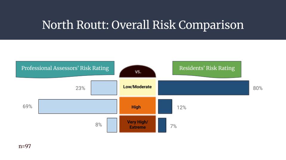
North Routt – 78%
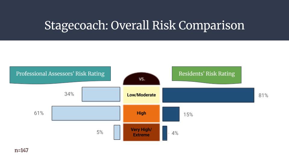
Stagecoach – 61%
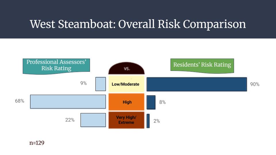
West Steamboat – 93%
The household surveys were returned at an average rate of 35%, which is very impressive considering they were 16 pages long… nice work, Routt County!
Interestingly, resident’s perceived risk vs. the actual risk of the properties consistently deviated, indicating that folks generally assume that their risk is less considerable than it actually is.

Let’s Give Our First Responders Some Help!
Another interesting discovery was that approximately 98% of homes have non-compliant and inadequate address signage that do not meet posting standards set by the fire districts and building code. So, we quickly started a program to raise awareness and provide an easy way for residents to order a reflective, code-compliant sign.
